


BaCengBaMoShan 巴層巴墨山 is a somewhat popular peak with great views at the top and along the way up. I hiked it a couple years ago and I’d recommend it. While I don’t usually hike a peak twice, I made an exception for this one after finding a possible route via the little known NeiWenShan 內文山 on the opposite side.
A Plan is Born
I first suspected this alternative route on my hike to the abandoned Paiwan Village, Tjakuvukuvulj. “內文山” (NeiWenShan) was listed on an old map nearby and I decided to hike there since I had some extra time.

There was what I had believed to be a hunter’s trail leading up to NeiWenShan. When I arrived at the peak I could see that there was a whiff of a trail heading down the ridge on the other side. Probably just the hunter’s trail, right? But turns out it was more than that.
A little research yielded THIS POST on the website Keepon. It had a map that showed a group hiking to BaCengBaMoShan from the other side!
They didn’t use the ridge to reach NeiWenshan but instead took what must have been a more difficult route along the side of the mountain. As it happens, the current main route to BaCengBaMoShan hasn’t always been there. It was opened some years ago – I’d assume sometime after this group hiked it in 2009. After its opening, you can imagine that few would want to hike the old trail.
Armed with this new knowledge, I figured I’d set out to see what I could find out there!
The Drive Up
I have a video of the ride from my house to as far up the mountain as I could safely drive my motorcycle. I was planning to make a narrated video of the entire hike, but I didn’t get around to finishing it. Unless someone is filming you for a decent portion of it, the first person point of view just seems boring to me. And I’m sure as hell not going to set up a camera, walk back the way I came, then come back pretending this was my first time there. Lame! (Yeah, I’m taking a shot at those who do it!)
Anyway, here’s that video.
Here’s a few pictures.
I also have this rough edit of the entire hike that I was going to use as the opening sequence. This one is probably more interesting.
As mentioned in the Tjakuvukuvulj post, getting to the trail head is an achievement in its own right. Unless you have an offroad capable motorcycle and a lot of determination…I’d park early and start there.
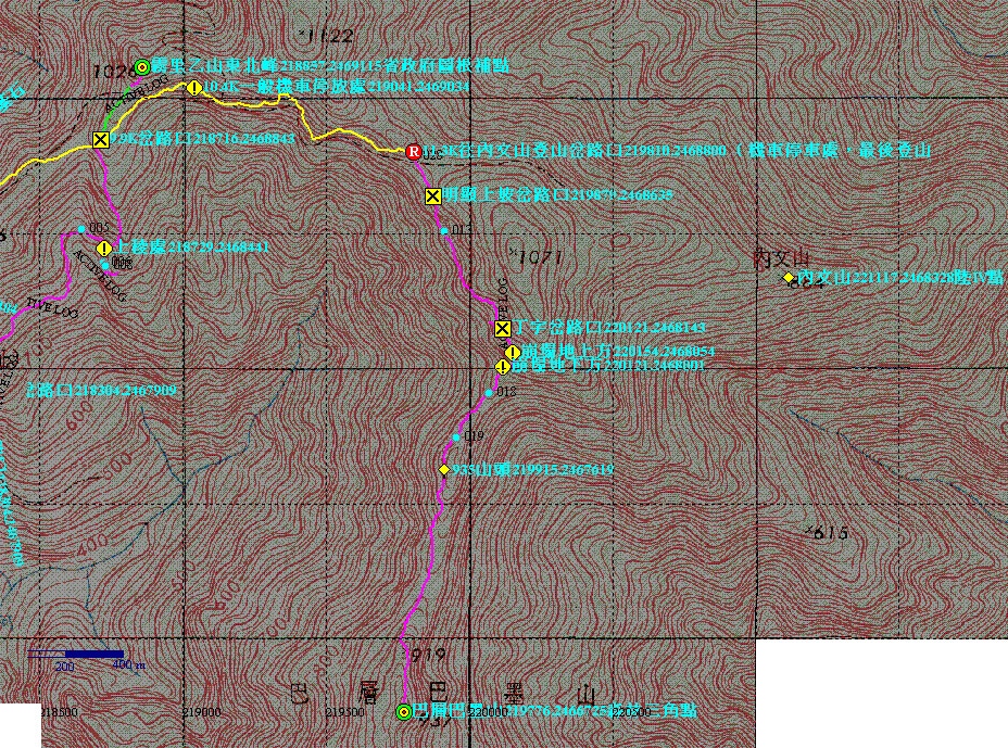
Here’s a map I made for that video. The red line is what most vehicles can drive safely more or less. The yellow line is for motorcycles only if you’re up for it. That’s all that’s relevant for this part of the hike, but in case you’re wondering…the light blue line is what I had hiked before; there’s a more or less clear trail for most of it…the dark blue line was all new to me…and the green line is the current route to BaCengBaMoShan. Click the map for a much larger picture.
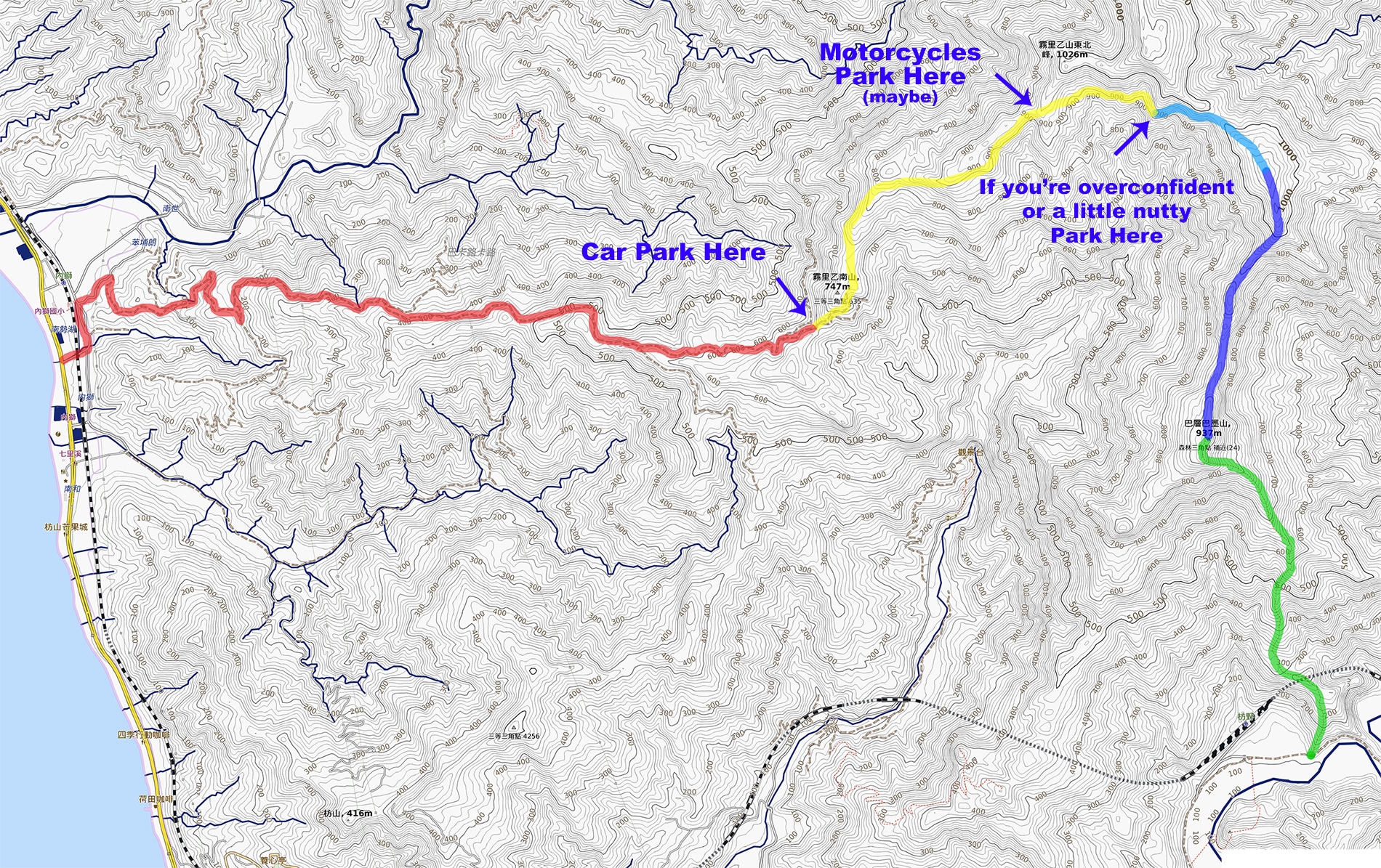
As you might have noticed, this COULD be hiked as a sort of through-hike. Just keep in mind, if you want to come out on the other side, whoever will pick you up will need to sign in at the guard station. It’s quite informal; just an ID and the license plate number is all they want. Or you could just walk to the guard station and meet them there if you arrive early – it’s not so far.
Hike To NeiWenShan – 內文山
I don’t have a lot to write about for this section since I’ve already written about it HERE. I drove as far as the end of the yellow line above and probably should have stopped earlier, as there were a couple sections that weren’t so safe for motorcycles.
The place I parked seemed to be some sort of “staging area” for hunters. There was also a simple snare trap rigged off to the side. Can you see it?


From here I hiked roughly forty minutes before I arrived at NeiWenShan.
The odd squarish concrete “thing” was still there.

As well as this square hole inside a layer of concrete nearby.

For a bit more info on these two things and the hike to Neiwenshan, check out this post.
All New From Here!
Now it was time to see if there was a trail to BaCengBaMoShan from NeiWenShan. I mentioned in the beginning of this post how I felt there was one…and yeah, there was something to follow. Whether it was a game trail, hunter’s trail, or what remained of the old trail, I couldn’t be certain. There were no trail ribbons to guide me. So I just followed the ridge down. I knew approximately where I needed to cut down to the ridge that would take me to BaCengBaMoShan, so trail ribbons weren’t really necessary.
There wasn’t anything of interest to see in the beginning.

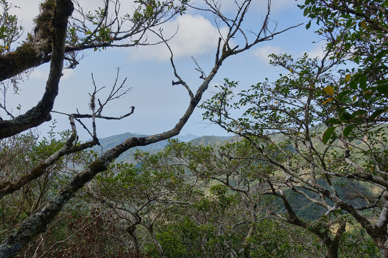
The views were nonexistent with the exception of this one, as scant as it is.
But then something happened. It slowly started opening up.

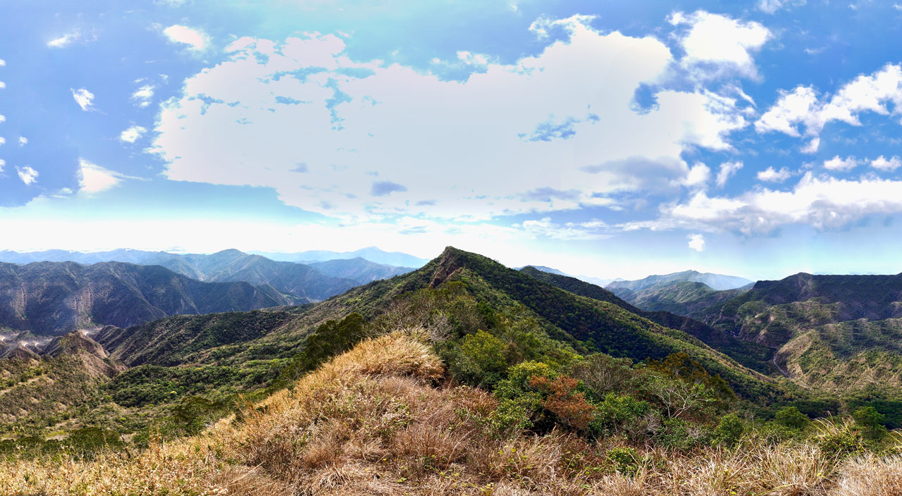
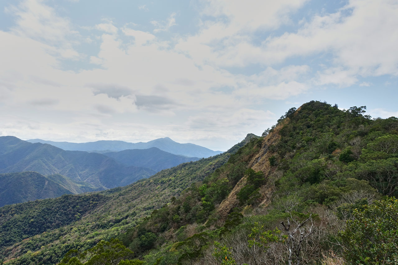
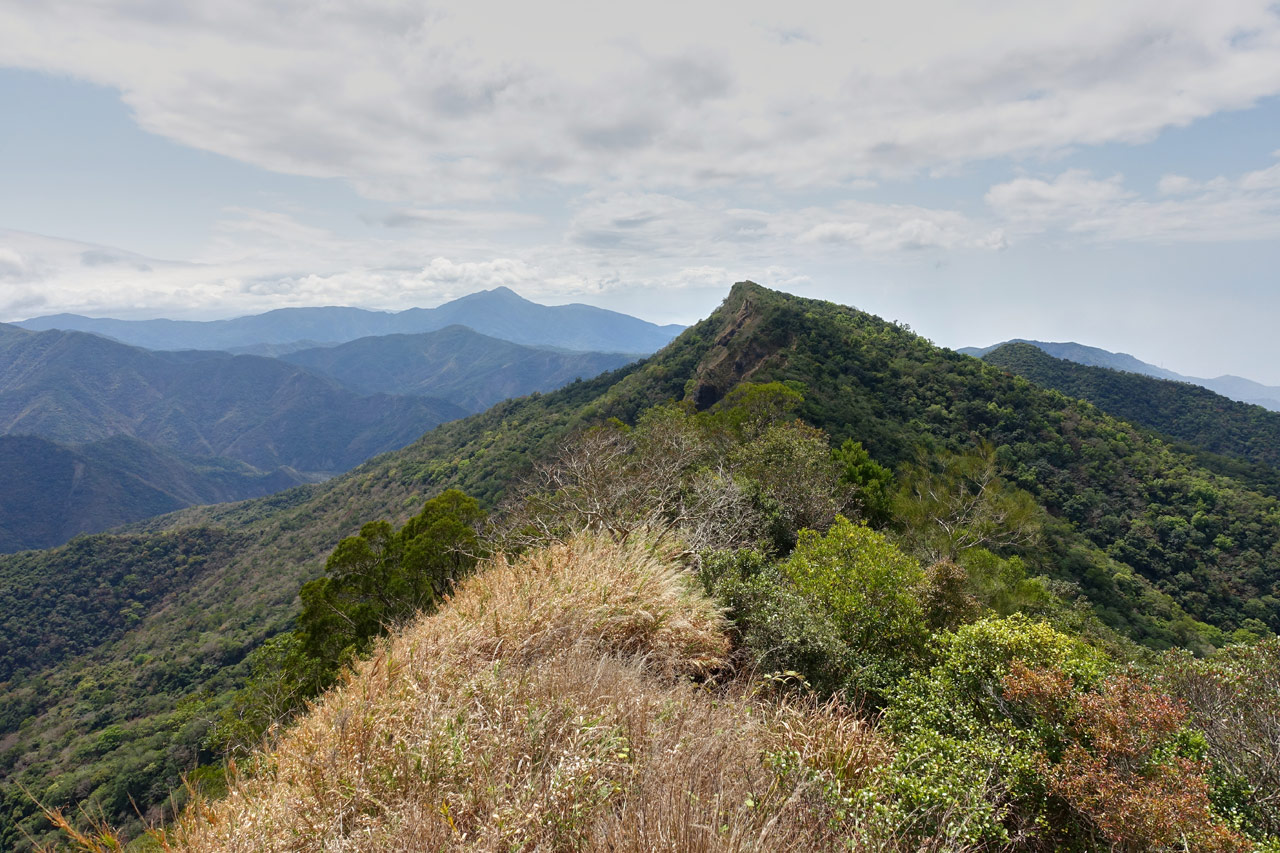
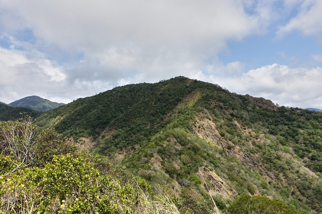
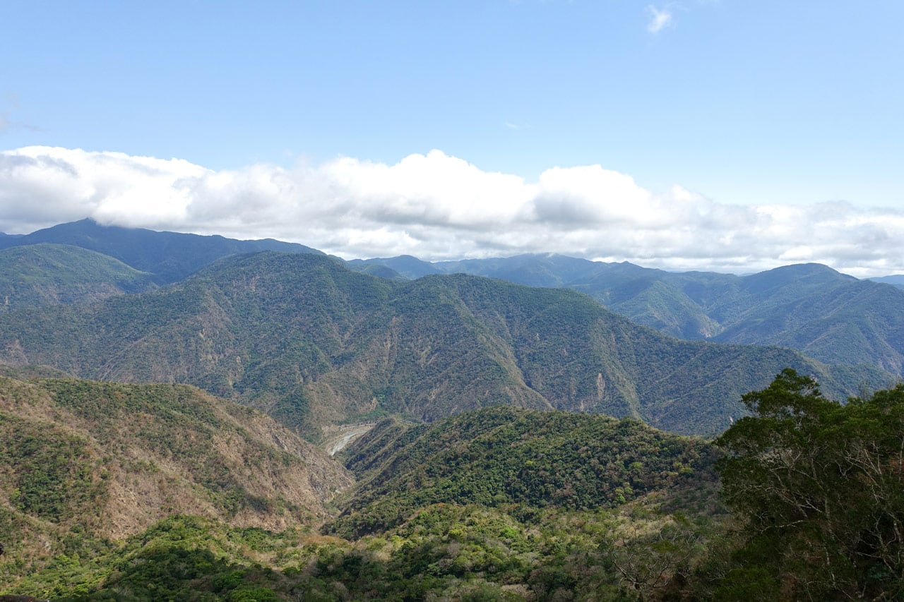
Roughly one hour after setting off I was greeted by something I was honestly NOT expecting…
Exposed Ridge!
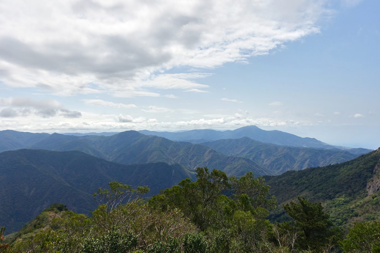
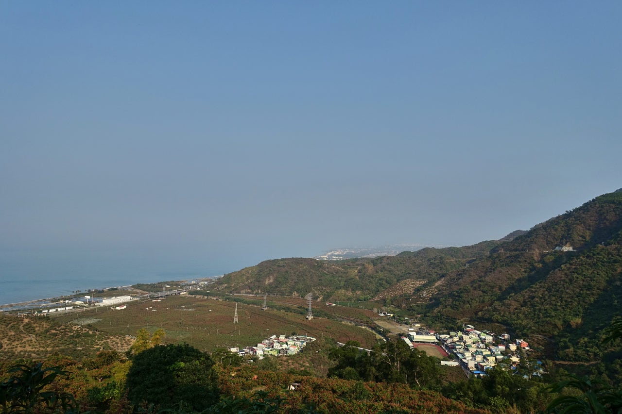
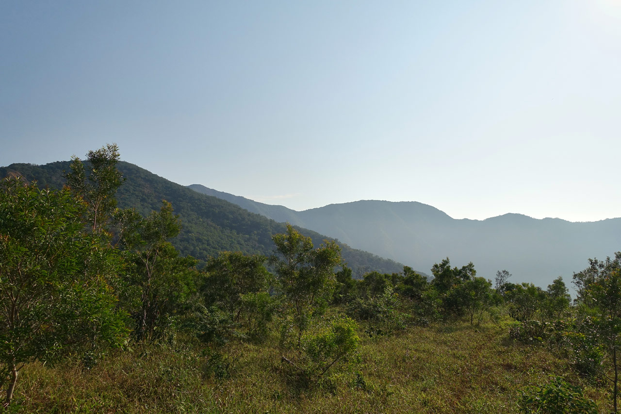
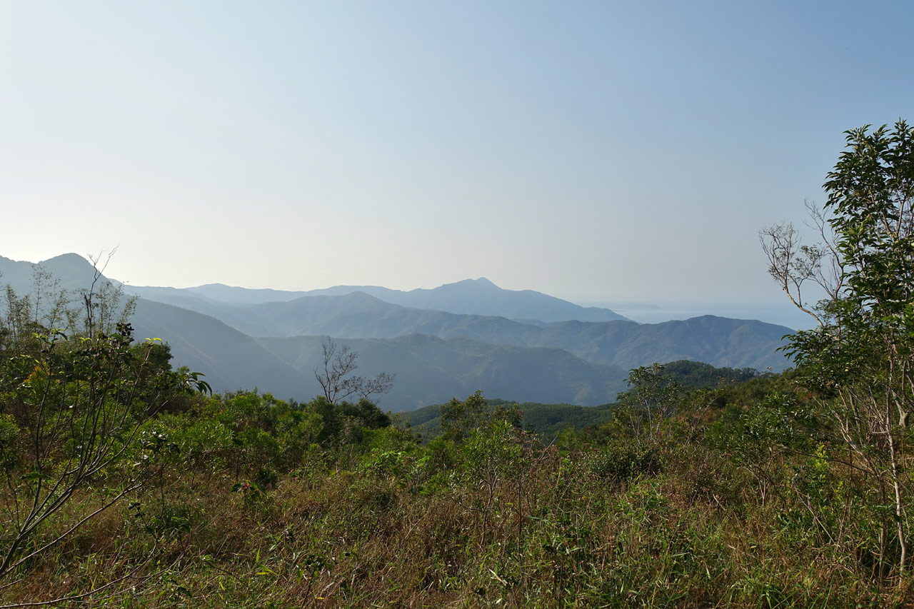
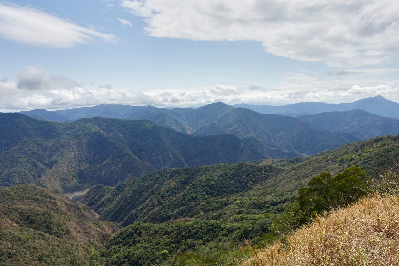
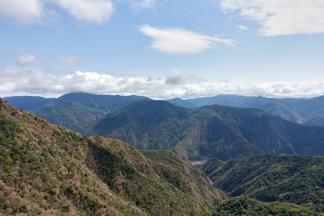
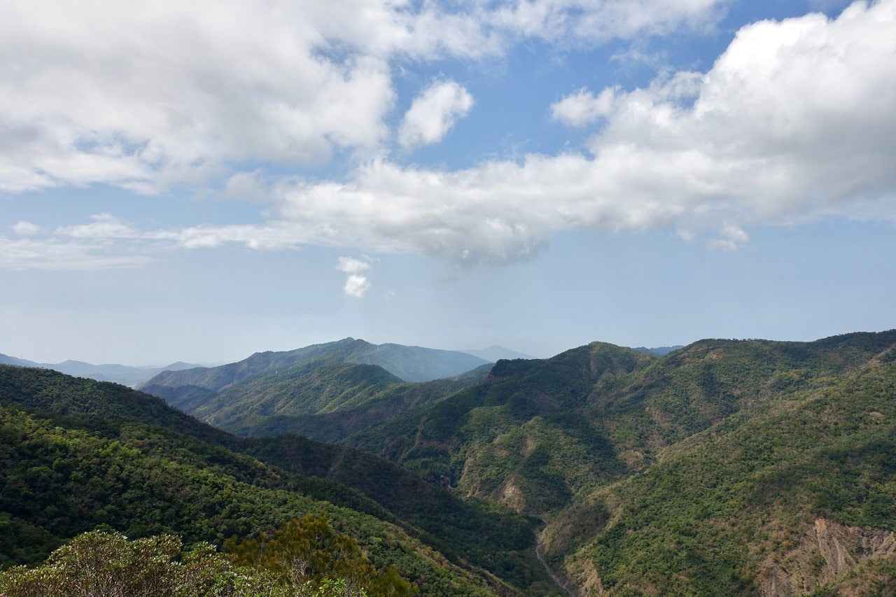
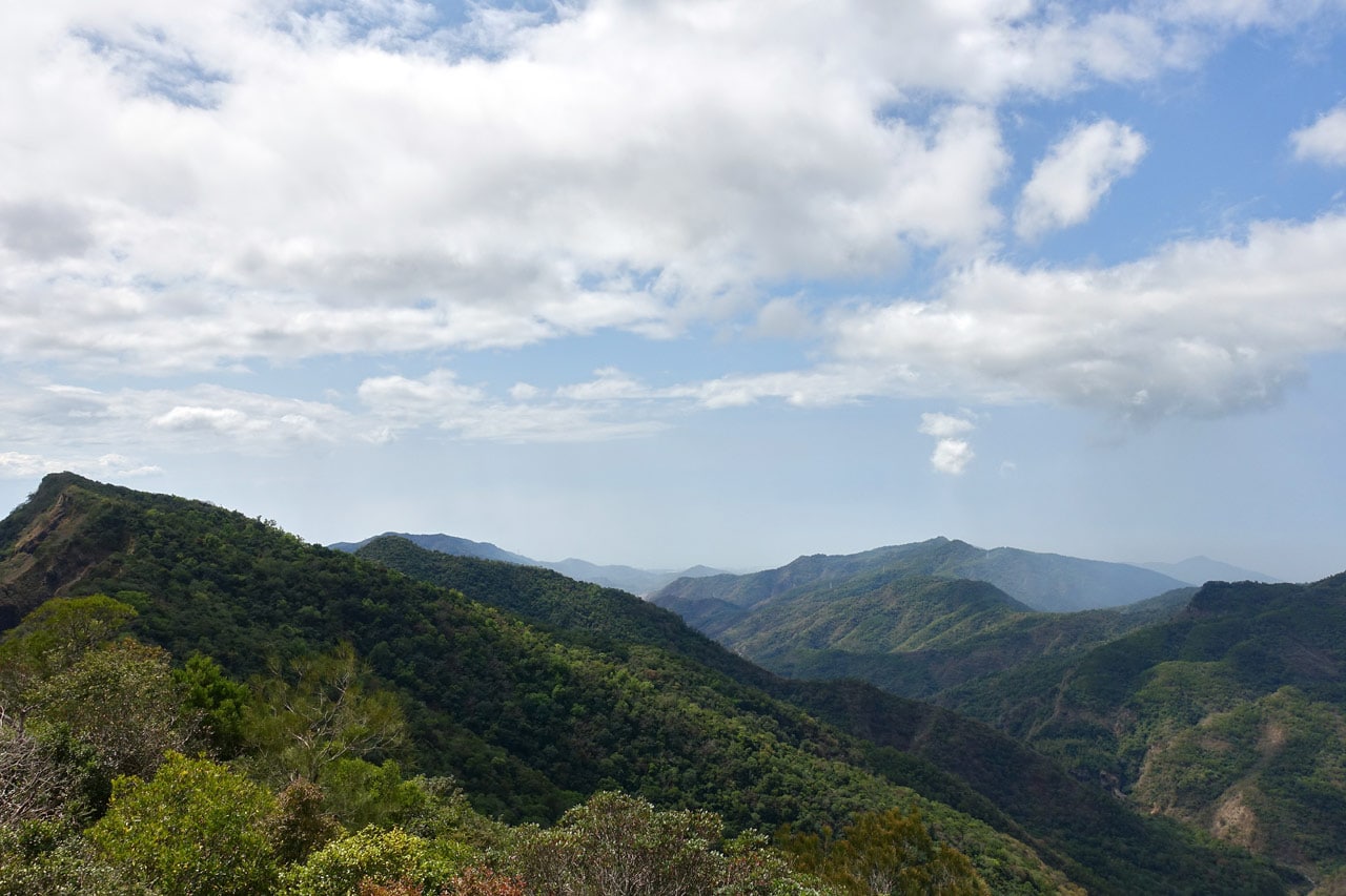
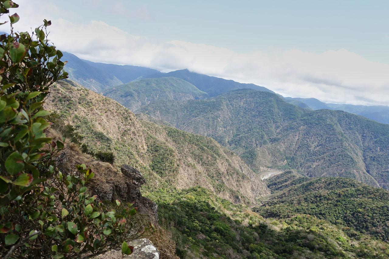
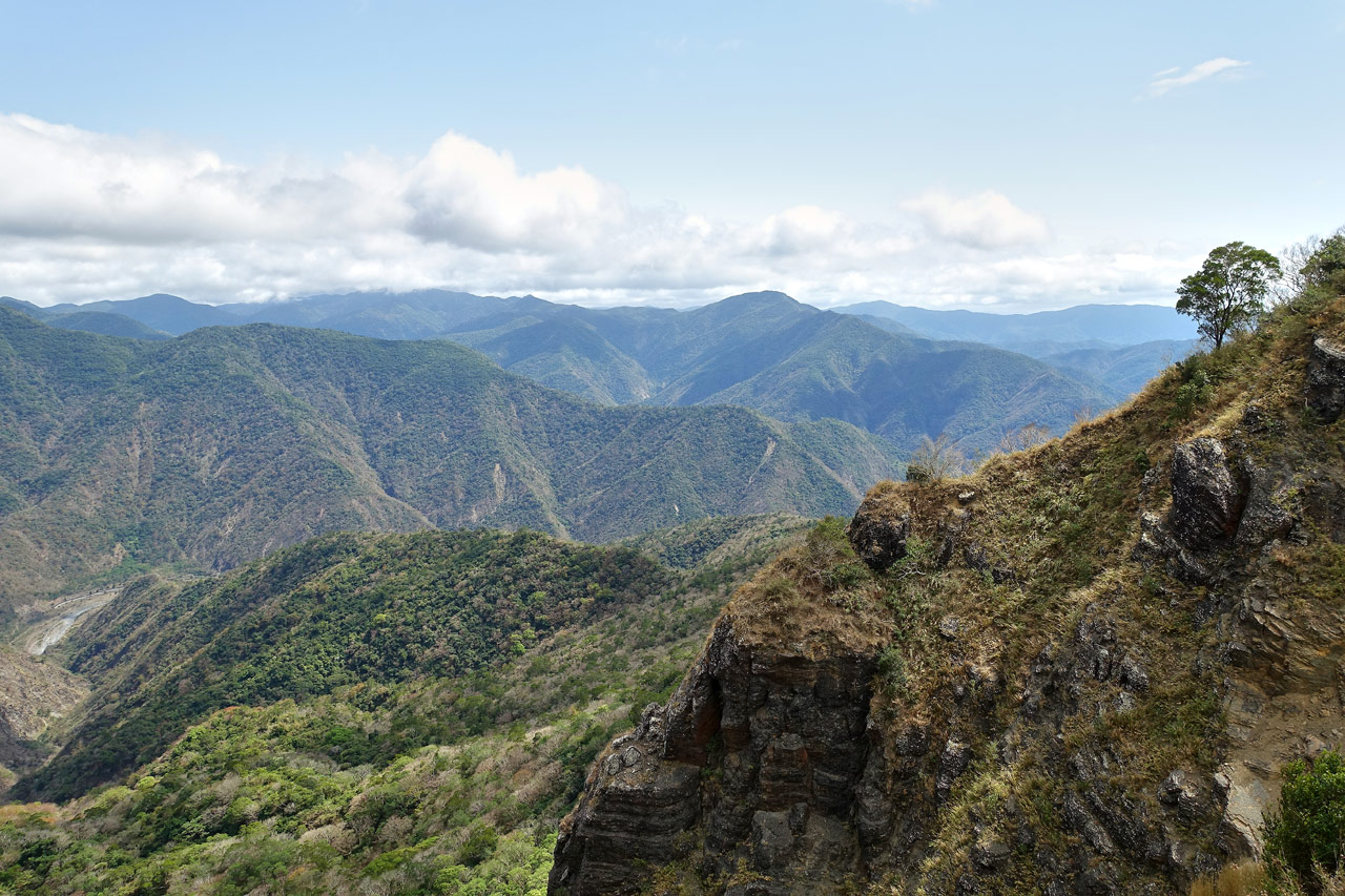
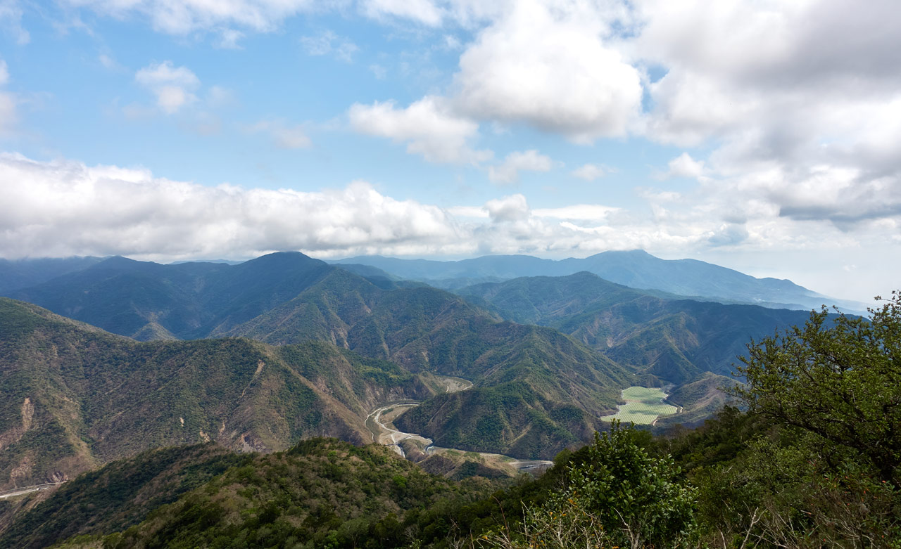
The ridge opened up to this magnificent view of the mountains and the ocean…and also of BaCengBaMoShan!
There were various spots along the ridge to get better and different angled pictures of the whole area. So I took advantage of it and shot a billion pictures! hahaha…
BUT…I fucked up. And I’m still kicking myself for this. For whatever reason I had switched my camera from RAW to JPG mode some days earlier and forgot to switch it back! So all of my pictures from this hike (until I realized my blunder a few hours later) are camera rendered JPG files. Makes me want to cry. But…that means I have a reason to go back on a clear day, right?
I did have my DJI Osmo Pocket with me. Here’s a couple stitched shots from that.
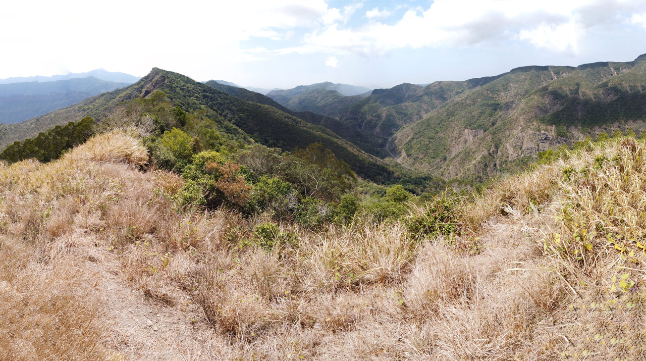
The river to the right goes to Kayoufeng Waterfall – 卡悠峯瀑布. But that route would require you to take “the long way down” the falls. Best come up from the other side. 🙂
I have so many more pictures from here, but they look more or less alike. So I’ll save us both some time and not post them here.
The Path Down
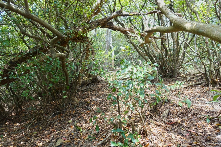
After a twenty minute picture break I made my way over to where I thought the path down the nearby ridge should be. I didn’t see anything to begin with, but when I got to the area in the picture below…
I found a clear path down next to those bushes there on the bottom right. Perfect!
According to my topo map, this would be the steepest part of the hike. It was steep, but it wasn’t so bad.


And the good part was that there was a trail to follow the whole way down.
Once the ridge leveled off some…


…I was greeted by a little surprise.

A crude stone marker of some sort!


There was no writing on it of any kind. I’ve searched through every map I could find and didn’t see any reference to it. Someone put it there for some reason…I’m beyond curious as to why. Let’s hope the reason isn’t lost to time.
Slippery Yoga Slope
Not long after the mysterious stone I came to my first sorta-challenge.

There was no actual trail to follow here. I wasn’t sure if I should stick with the top of the ridge as best as possible, or drop down the side a bit and hike it until it looked better up top. I chose the former.
Here’s a video that shows that section of the hike.
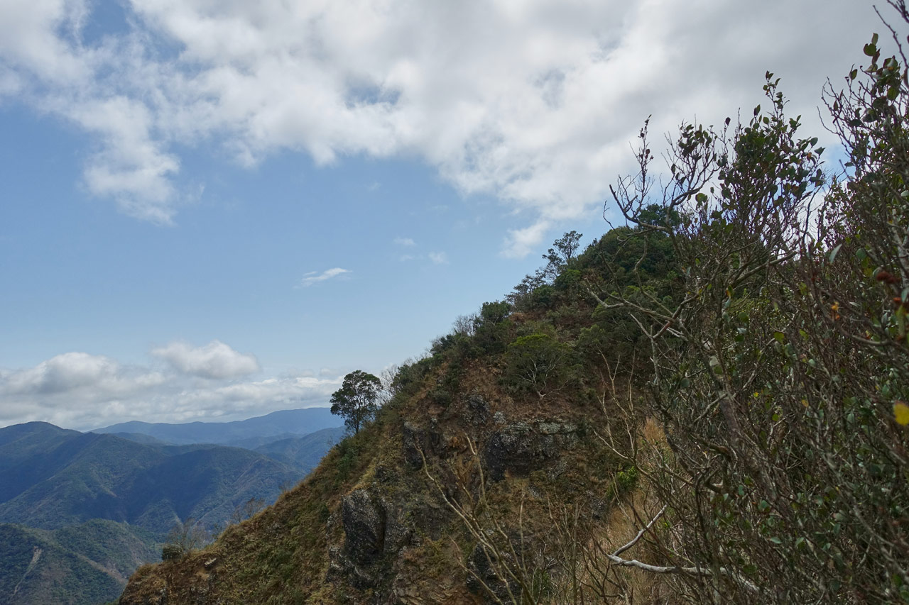
This little section of ridge I emerged from had nice views of the south side of the ridge.

The Saddle, The Serow, and The Shit
Yeah, I said it…the shit.

From the looks of it I guessed a serow. I had seen one the last time I was at NeiWenShan. The thing waited until I was within a meter of it before bolting off. It scared the living shit out of me! Well, this time I would be ready for it.
But first I needed to climb up to where it was hiding. (Yeah, I found it. I wonder if it was the same one?)
I hiked down the ridge to a nice little quiet saddle.

I suppose this area could work as a campsite if needed. But I’m not sure why anyone would need to hike this as an overnight.
It looked somewhat steep to me, so I searched for an easier way up. I found one, but it was unnecessary. On my way back I came straight down the slope and it wasn’t a problem.
I made my way up the ridge hoping there would be a view at the top of this little peak I was ascending.

And right around here is where I first heard it…

Heard what? Well, the serow of course!
And guess what? I’ve got a video of that too!
I call that “human/serow relations”. Hope that doesn’t sound lewd.
The serow took off never to be seen by me again. And who would blame him, right? Imagine seeing me climbing up a mountain screeching at you. I’d run too!
Anyway…
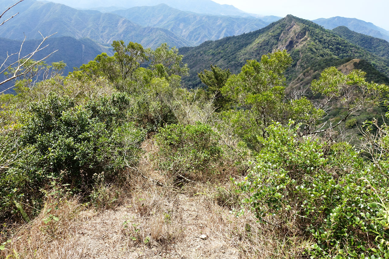
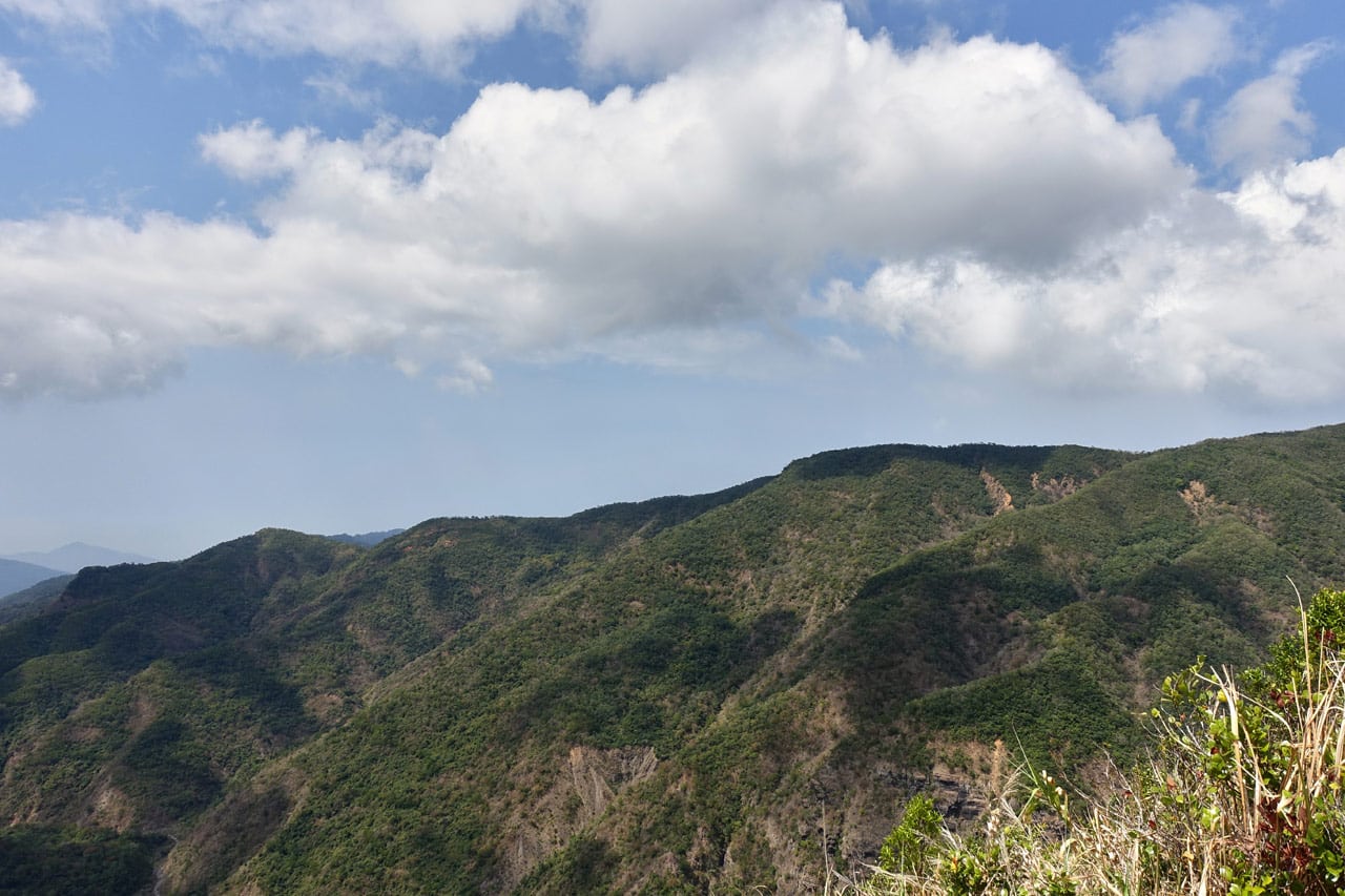
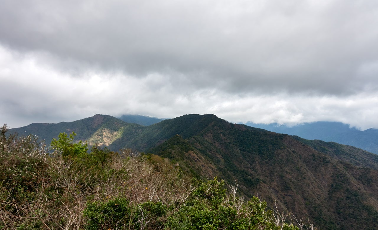
When I finally made it to the top I wasn’t disappointed! Oh what a view it had! A complete unobstructed 360 degree view!
I’ll tell you what…it felt so good standing there, with the cool wind blowing and all the views, that I felt like stopping and calling it a day – just spend a couple hours here and hike back to my bike. BUT…I needed to prove to myself that I could make it to BaCengBaMoShan via this ridge. So on I went…
Here’s a 360 video look at the area if you’re interested.
More Ridge Mystery
The next part of the ridge wasn’t interesting until it was. (that makes total sense and no sense all at the same time, huh?)

I found one of the few signs up there of human activity. Hikers or hunters likely cut those.

Then more and more trees that looked more or less the same…


…until I spied something definitely unnatural.

Four sets of stones lined up roughly in a rectangular shape.
These are definitely aboriginal in origin. The notched stones used to hold something from what I’ve learned; perhaps a wood beam or something similar.


Not far from this location is an abandoned aboriginal village named Tjuru’aljuvuljuvung.
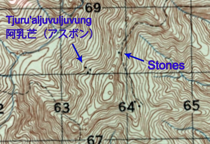
That little dot represents the stones. I’m in no position to guess what kind of structure it might have once been. But whatever it was, someone thought it important enough to include on a map, even if just a small dot. Another mystery I’ll never find an answer to I suppose.
Only One Way to Go From Here: Up!
The next little section of ridge was somewhat interesting. Or rather, it had a few interesting features.

No, not this ribbon. Though I think it was the one and only trail ribbon I found that day. It’s definitely worth including here, wouldn’t you say?

And no, not this jumble of trees and plants. It’s not very interesting. But THESE rocks were interesting to me…but for a dumb reason.

When I first saw them from a distance I thought they were something made by aboriginals. Perhaps a house or something. Then I got closer and…doh!
*Sigh* Just rocks…
But not long after those rocks came this sort of “depression” in the ridge. Here’s me looking down at it from the side.


This area was quiet and creepy. No animals or sounds of any kind really. Even the wind was blocked from reaching this place. Just an interesting “feature” in my opinion.
After passing through the depression I found this interesting looking (probably) dead tree.


I’m told that it possibly could be alive by someone in the know, but I’m not sure I agree. It seems pretty darn dead to me.
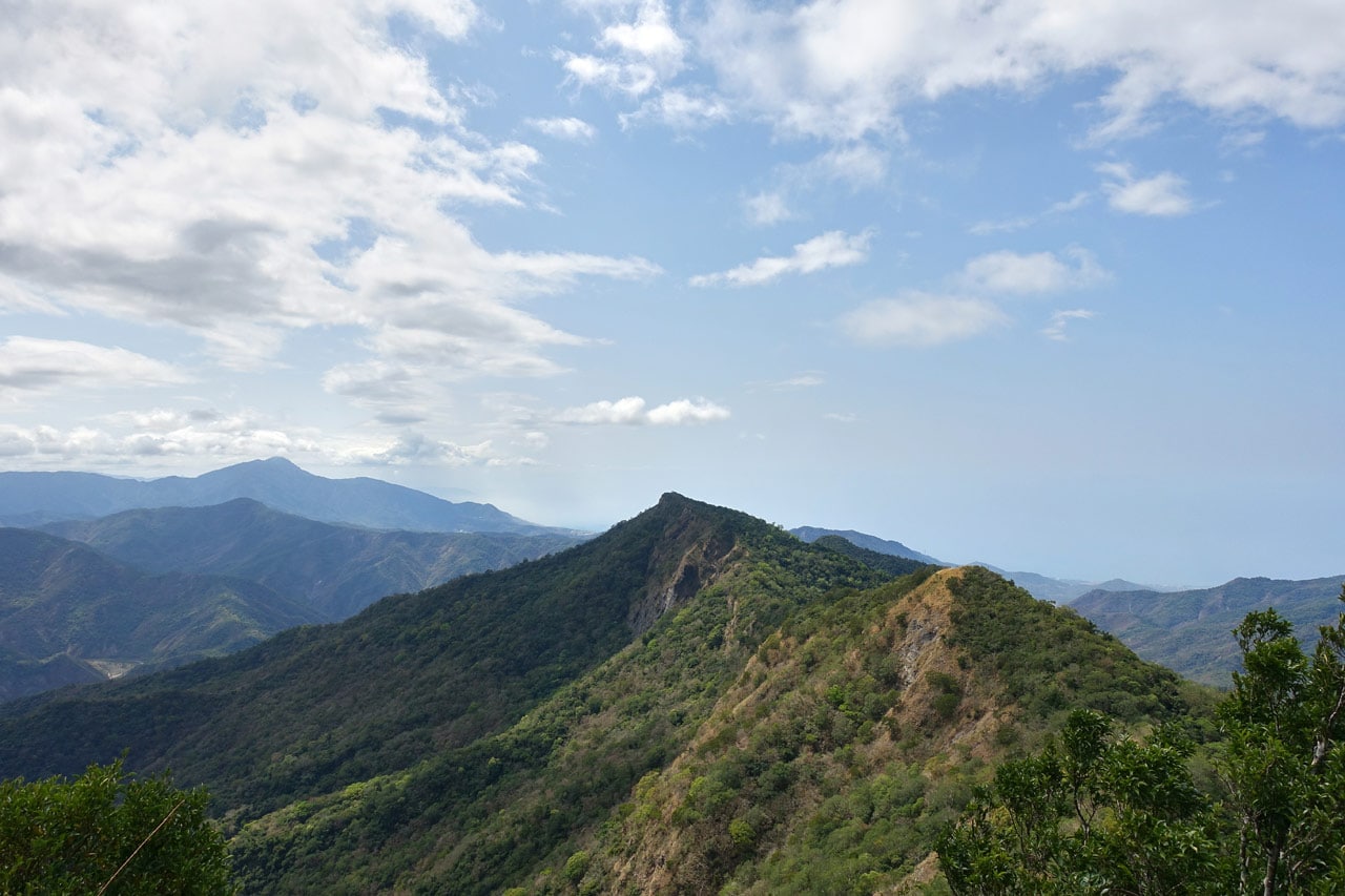
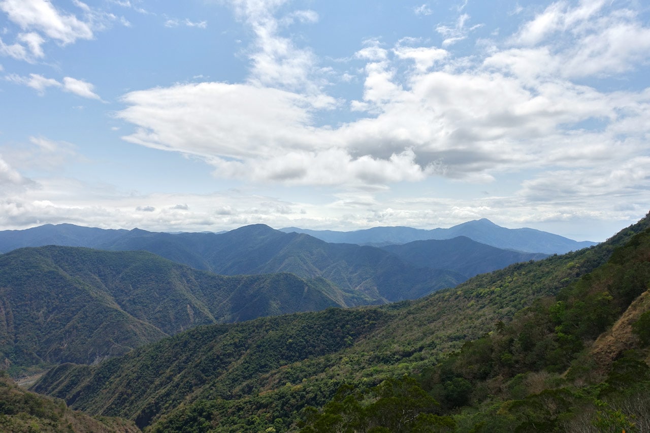
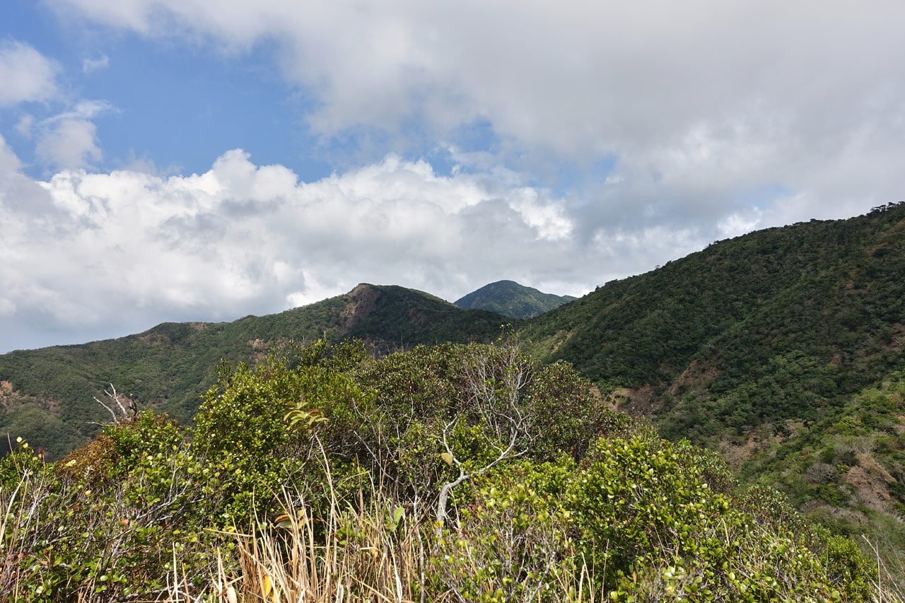
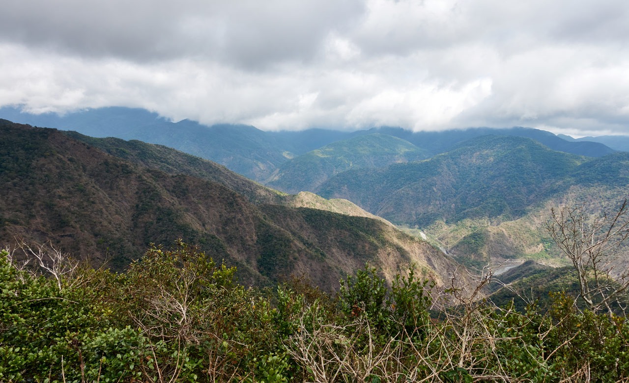
About a minute from the tree came another natural “viewing platform”. A landslide cleared the way for this view.
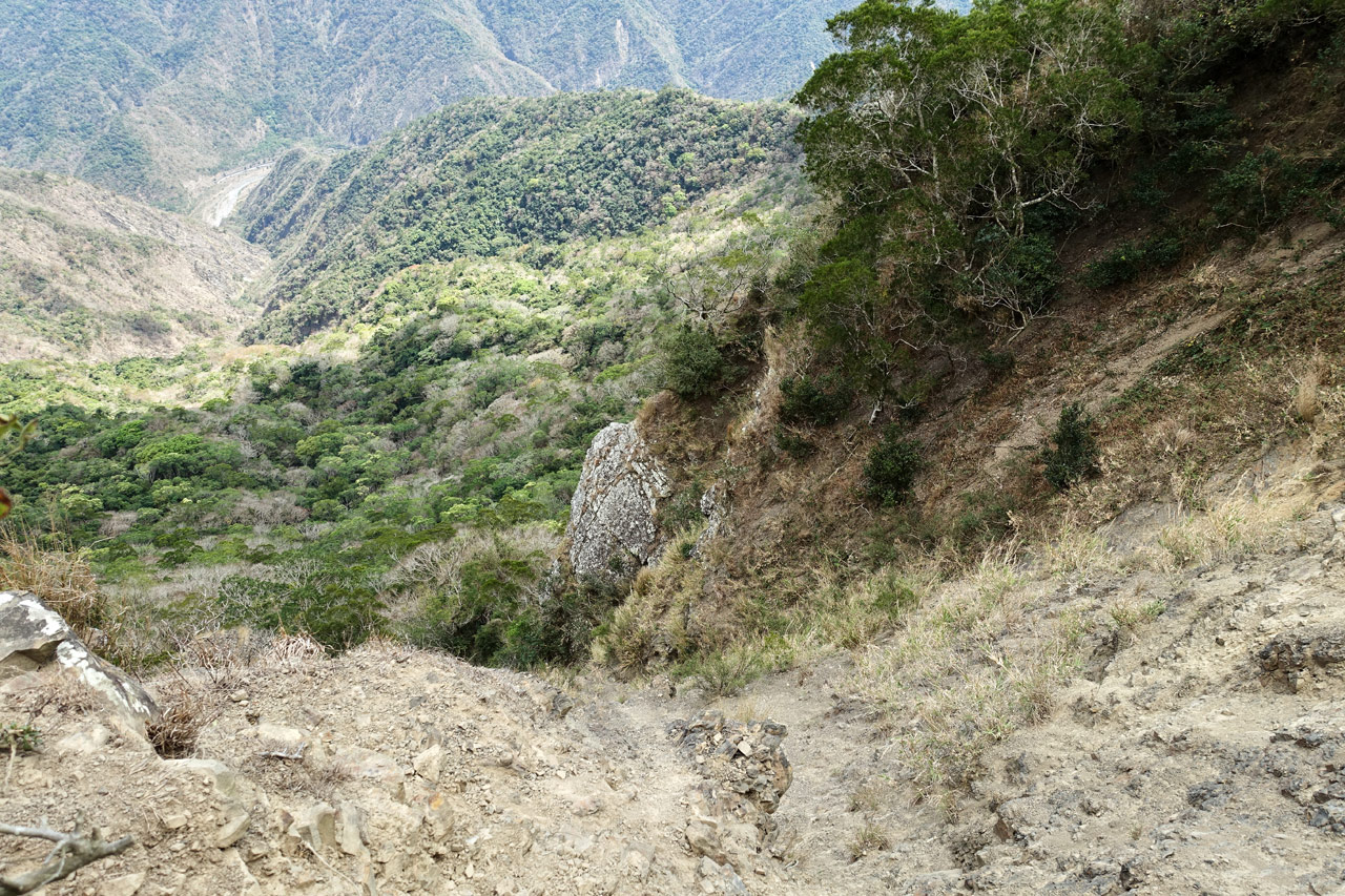
And would you look at that! My destination is somewhere up there. Except…there’s no easy way to reach it from here.
The Final Push
Partially because of this landslide and partially because of natural land features, there’s no way to directly climb the ridge from here. You need to work your way around the west side of the ridge and come up from the other side a bit. This part wasn’t all that nice. I have but two pictures to share with you.
The first is along the side of the ridge.

There was no real path or trail to follow. It got a little steep and messy in places. My machete was very handy here.
It took some doing, but I did find my way to the top of the ridge again. And I was SOOOOOOO close to the peak…but then, right before reaching the triangulation stone, it got all nasty.

And that wasn’t the worst of it. As I neared the end, it was just a damn mess. I pushed, pulled, hacked, crawled, and forced my way to the peak. After all that effort I was praying someone was there to see this determined foreigner come crashing through the jungle, machete in hand yelling something triumphant like, “Oh FINALLY! FUCK…” (That’s my tagline when reaching most any peak.) But alas, no one was there to see my dramatic entrance. What a shame. *sigh*
Oh here…it looked like this:

BaCengBaMoShan – 巴層巴墨山
What can I say about BaCengBaMoShan? I had been there already; there were no surprises. Except…the watermelon river was still there! I had totally expected it to be gone by then.
The above picture was taken after I had finally noticed my camera was in JPG mode. After I switched back to RAW I shot a bunch more. Unfortunately the clouds were rolling in and I had missed the more picturesque weather.
So yeah, that’s basically the entire hike. Even though I’d been there already, I still took a peak picture…or five.


Sorry, I couldn’t choose just one.
If you noticed that yellow sign with red words on it…it must have gotten blown up there I assume. It says something about parking.
And for my last trick…I mean pictures. Here’s how the rest of the peak looks.


That stone standing up I believe belongs to the abandoned village I mentioned earlier, or another abandoned village on the opposite side of the mountain near the main trail. I think I read somewhere that this peak was sacred or somehow significant to the aboriginals that used to live nearby.

My Not-So-Interesting Conclusion
After nearly a one hour rest at the top, I made my way back to my bike without incident. It took me under three hours. I have nothing more interesting than that fact to add to the story.
So would I recommend others to try this route? Hell yeah I would! Or at least hike as far as that little unnamed peak between NeiWenShan and BaCengBaMoShan on a nice day. That would be worth it in my opinion. But it’s not so far to BaCengBaMoShan from there, so why not go all the way? Just bring a machete and a strong will. Enjoy!
Date hiked: 2021 Mar 09
GPX Track Download Instructions: Click the track on the map to see the download link

![[Valid RSS]](https://outrecording.b-cdn.net/wp-content/uploads/2020/03/valid-rss-rogers.png.webp)
Leave a Reply