


A couple weeks back I hiked BaCengBaMoShan 巴層巴墨山 and really enjoyed the area, especially the watermelon river. While researching that hike I learned of WaiMaLiBaShan 外麻里巴山. It didn’t look particularly interesting, but I thought it would give me the chance to go back and see the watermelons before they were gone.
When I researched WaiMaLiBaShan there wasn’t much information about it past 2015. To me that meant that something had happened and the peak was inaccessible or it wasn’t a hike many people wanted to do. Either way, it seemed the trail wouldn’t be in good shape and would present a challenge. Just what I wanted!
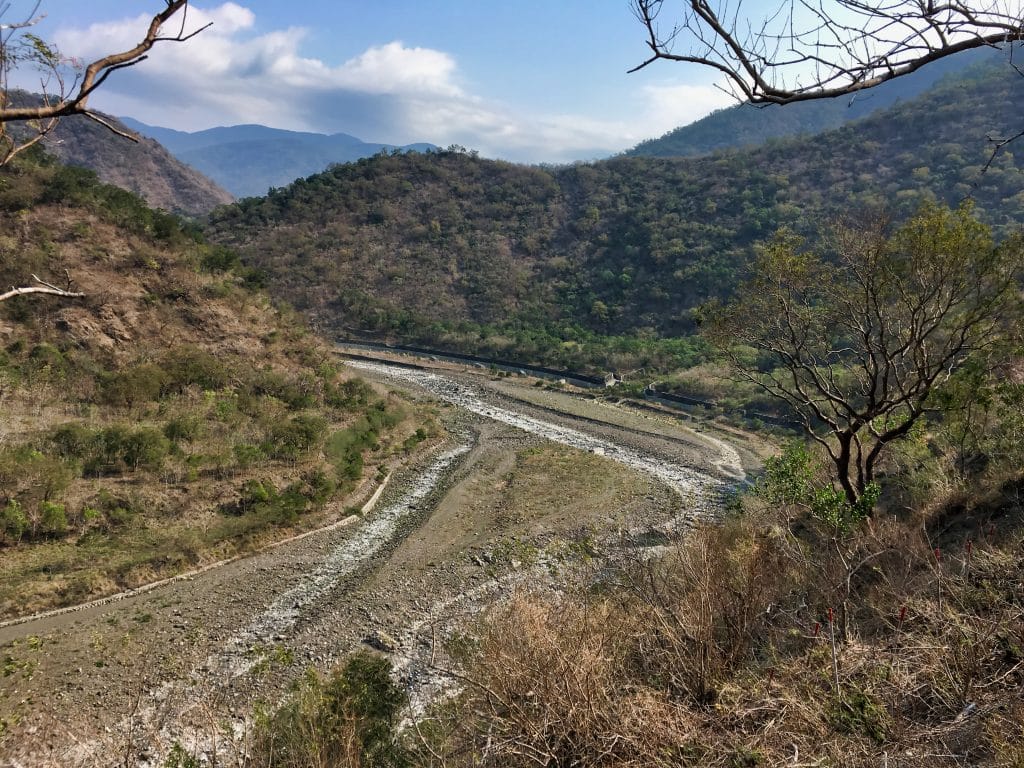
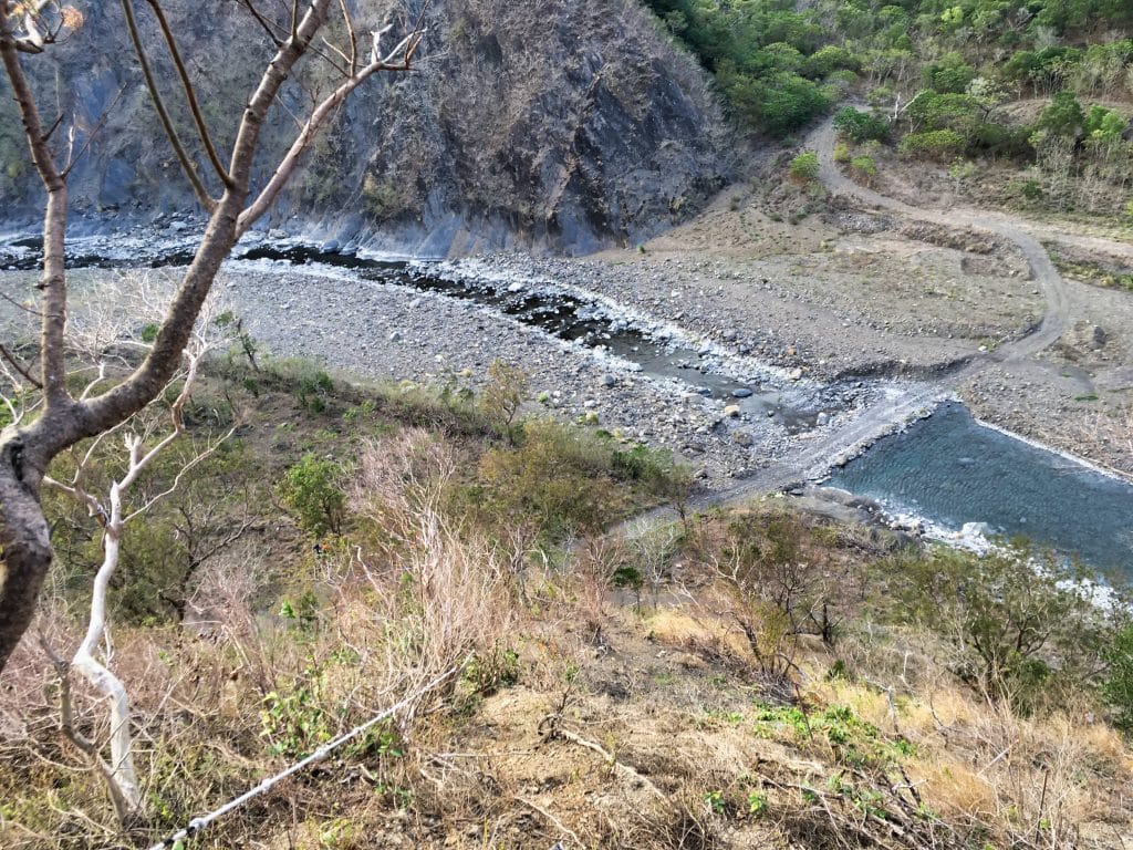
When I arrived at the watermelon river (the XiDouJiao River 西都驕溪) most of the watermelons had been harvested and it didn’t look nearly as pretty as it did a few weeks earlier.


Let me stop here and apologize for the quality of most of my pictures. The weather wasn’t great and for some reason I just couldn’t get a decent shot out of my camera. Very few pics seemed to turn out acceptable.
Ok, back to the hike…
WaiMaLiBaShan is located past the guard hut, further down from BaCengBaMoShan but is still accessible by two or four wheeled vehicles.
I made it through the checkpoint quicker this time around. Perhaps the guard remembered me from before. A short drive later brought me to a T-intersection.

I’ve seen old signs like the one on the right a few times in the mountains. If I remember correctly, they’re asking you not to start forest fires or something.
A left hand turn here will take you to a railroad bridge.


It would be fun to find a spot nearby to just watch the trains shoot out of one mountain and into another. I didn’t see any as I drove in and out of the area, but I caught a glimpse of one as I was climbing up, and heard a lot during my hike.
From here you can see WaiMaLiBaShan.
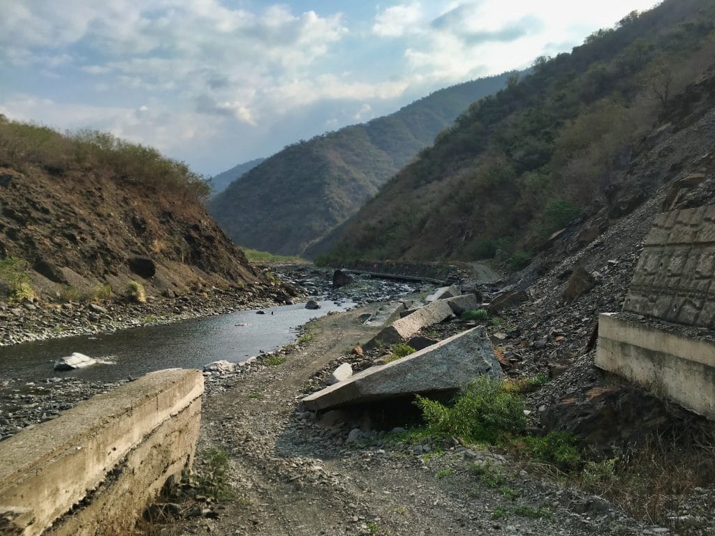
Well, you can’t see the peak but you can see most of the mountain.
Directly across from the trailhead is a small area to park. There were two scooters and one blue truck already parked there. I met no other hikers that day so they must have been workers.
As you can see from the picture above, it starts off rather steeply; though the trailhead doesn’t look so bad.

However, the entire beginning of the hike is pretty much just straight up.


There were several ropes throughout the beginning to help you along. Too bad I missed some of them!
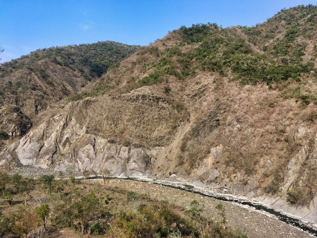
I had a problem finding the trail at times; likely because it wasn’t really there. The mountainside looks like it has collapsed in some areas. For example, the trailhead I found was in a different location from the GPX track I had been using. But in other places overgrowth covered the trail. Also, it didn’t help that there were many, I don’t know what to call them…perhaps, “surveying trails” or “experiment trails”. There were a lot of these bamboo sticks all over the side of this mountain.

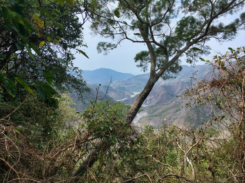
A small trail followed them wherever they went. This must have been some type of experiment done by the Forestry Bureau or something similar. Sometimes the trail to WaiMaLiBaShan would follow their path and then break off at some point. I often missed the break-off point and had to create my own way up or backtrack and find it. It was somewhat slow going in the beginning. But on a good note, I was able to get some decent views on the way up.
Maybe you can see my bike down there in the picture below?
If you look at the water in the pic above you’ll notice little waves. It was SUPER windy that day…even windier than when I climbed BaCengBaMoShan. I have to guess that strong winds are a feature of this area. More on that later.
I found this makeshift ladder tied up to the side of the mountain. It serves no purpose now. Maybe it was useful years ago.

It probably took me a good 40 minutes to climb my way up to some actual vegetation. It felt good to get out of the wind.

This led to a little crease in the mountain where water would flow down during a rain. It was mostly clear of trees so I could pick up the pace until it started getting steep.


About thirty minutes after this section I got a nice view of the watermelon river. It still looked nice and green from this distance. But too bad that tree was smack dab in the middle.
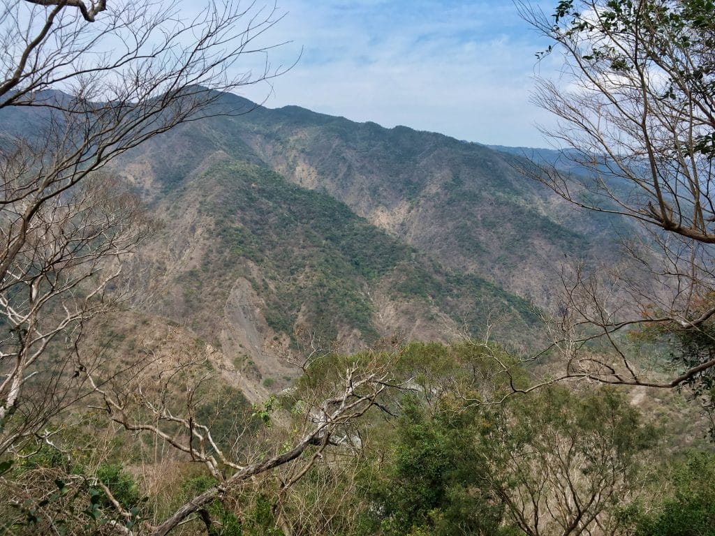
As I hiked up the ridge and it eventually leveled out some.

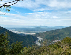
I was close to halfway to the peak now. This is last place you’ll get a view of anything.
And if you’re lucky you’ll find this cool little tree “splitting” another tree. 🙂


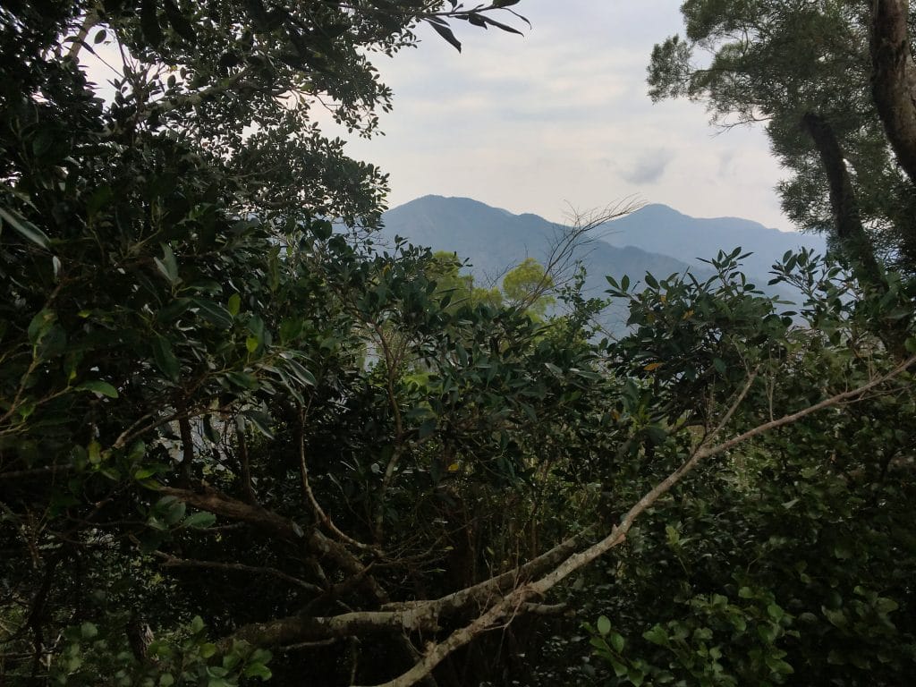
There isn’t a whole lot of interesting things to see from the midpoint of the hike til nearing the peak. All I can show you is this (banyan?) tree.

Nearing the top I came across an old road.


At least I think it was a road. The GPX track I was following had it marked as an abandoned road. It certainly looks to me like many old roads I’ve come across in the mountains. But I can’t find any roads on any of the maps I’ve looked at. Nothing comes remotely close. A mystery for another day.
Past this “road” I began to notice a lot of downed trees.


The further I went up the more downed trees I saw.


This little stick of a tree appears to be holding up this huge fallen tree. haha…

I was now at the top of the mountain. What should have been an easy walk to the peak took a lot longer due to the downed trees. At first I guessed that a typhoon or two must have went right over this mountain, causing all this havoc. But when I hiked BaCengBaMoShan, which isn’t far from here, I didn’t see any damage even remotely close to this. My other guess is simply the constant winds this mountain must get. I can imagine the wind getting quite strong even during normal storms. So maybe it’s a combo of both normal winds and typhoon damage. Whatever the reason, all these trees were slowing me down. Even the smaller ones.

But at last…I made it.

There wasn’t much to see up there and only a tiny window of a view…sorta…
As usual, I took pics of what I could find and my triumphant peak pic!


It took me about 3 hours and 45 minutes to reach the peak. It was about 12:45pm which was great. I had plenty of time to eat, rest and to make my way back down. And believe me, I took as much time as I could. I’m usually running against the clock. It felt good to be able to take my time.
After my long rest I strolled back down. Yeah, strolled! I stopped here and there and looked at this and that. I didn’t find anything worth sharing, except maybe these holes I found dug everywhere.

I was told they were likely dug by a Pangolin. That seems about right to me given the size of the holes.
Oh, that reminds me. I saw SO MUCH CRAP! I mean, poop…or shit…whatever you want to call it. I’ll usually see a lot of goat-like pebble sized poop (and this one had PLENTY) but I also found monkey crap, wild boar crap, and even some HUGE turds that rival the largest dump that I’ve ever taken. I was half scared to encounter what dropped those double deuces!
Jokes aside, there really was a lot of poop on that mountain. It’s a clear winner of all the mountains I’ve hiked so far.
One last note about this hike. Plan to not have any cellphone signal. In one place I had a tiny sliver of reception for a few minutes. Other than that, nothing.
So that’s the hike. I made it down without incident and with plenty of daylight left. I’m not sure if I would recommend this hike to anyone unless you’re like me and enjoy a challenge. There are plenty of better hikes out there.
Date hiked: 2019 March 13
GPX Track Download Instructions: Click the track on the map to see the download link
I’m dropping both of my tracks (up and down) because I got off trail a lot on the way up.

![[Valid RSS]](https://outrecording.b-cdn.net/wp-content/uploads/2020/03/valid-rss-rogers.png.webp)
Another stellar account Mr Glenn. Some mates of mine did this one last year from your post; dubbed the Watermelon Hike. We’ll be trying our ascent tomorrow and hope the trail is discoverable. Thank you for the valuable resources.
Thank you again! Do report back how it went. If anything has changed I’d like to make a note in the blog post. Thanks!
Mr Glenn
What a miserable hike. I should have honored your recommendation but a so-called friend encouraged us to this hike. The first hour-and-a-half was nothing more glorious than crawling around thorn bushes and rock slides. We gained less than 1km in this time.
We found the trail and made it to the top. No views, difficult to follow trail and thorn bushes and trees made innumerable and difficult to explain scratches upon our arms neck and even abdomen.
The drive up the resplendent river and watermelon patches was the highlight. I shall hold in much higher esteem your words.
Ah wait! Did you hike WaiMaLiBaShan??? I think your friend directed you to the wrong post/hike? The watermelon hike is to Bacengbamoshan, which is closer to the checkpoint. Here:
https://outrecording.com/great-hike-to-bacengbamoshan-%e5%b7%b4%e5%b1%a4%e5%b7%b4%e5%a2%a8%e5%b1%b1-in-shizi-taiwan/
Yes, hiking this wasn’t all that fun. But now you have a good reason to go back!
We hiked WaiMaLiBaShan. Sounds like we got the wrong hike. Yes, BaCengBaMoShan trailhead is nearby and it what we will try for next time.
Good luck with it! I think you’ll have a much better time with that one. Sorry to hear about the wrong peak, but it was still an experience. Now your next hike should feel pretty easy!